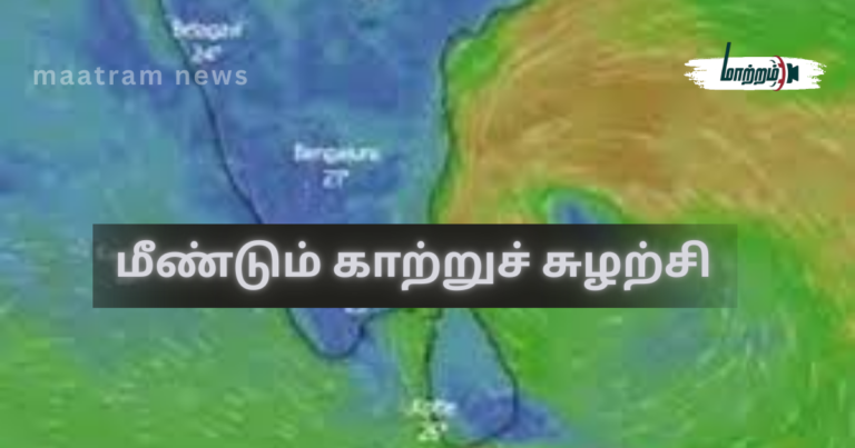
Cyclonic Circulation Once Again முன்னதாக 21.12.2025 அன்று தெரிவிக்கப்பட்டிருந்ததுபோன்று, 28.12.2025 அதிகாலை, தென்கிழக்கு வங்காள விரிகுடாவில், இந்தோனேசியாவுக்கு மேற்காக ஒரு காற்றுச் சுழற்சி உருவாகும் வாய்ப்பு அதிகம் காணப்படுகிறது.
இந்த காற்றுச் சுழற்சி, மேற்கு – வடமேற்கு திசை நோக்கி நகர்ந்து, 31.12.2025 அன்று இரவு,
அம்பாறை மாவட்டத்தின் திருக்கோவிலுக்கு கிழக்காக சுமார் 171 கி.மீ. தூரத்தில் நிலை கொண்டு, பின்னர் இலங்கையின் தென்கிழக்கு கரையை அண்மித்து,
அதனைத் தொடர்ந்து இலங்கையின் தெற்கு கரையோரமாக நகர்ந்து,
06.01.2026 அன்று குமரிக்கடலை சென்றடையும் என எதிர்பார்க்கப்படுகிறது.
முக்கிய கவனிக்க வேண்டிய விடயம்
டிட்வா புயல் உருவான போது, ஆரம்ப கட்டத்தில் இலங்கையின் தென்கிழக்கு பகுதியில் இருந்து மேற்கு நோக்கி நகர்ந்த அதே பாதையிலேயே, இம்முறை உருவாகும் காற்றுச் சுழற்சியும் நகரும் என எதிர்பார்க்கப்படுகிறது.
ஆனால், டிட்வா புயலைப் போல மீண்டும் கிழக்கு நோக்கி திரும்பி இலங்கையை நேரடியாக பாதிக்கும் சூழ்நிலை இம்முறை ஏற்படாது என தற்போதைய கணிப்புகள் தெரிவிக்கின்றன.
🌧️ மழை தொடர்பான முன்னறிவிப்பு
இதன் தாக்கத்தினால், 28.12.2025 முதல் 06.01.2026 வரை, நாடு முழுவதும் மிதமானது முதல் கனமானது வரை மழை பெய்யும் வாய்ப்பு உள்ளது.
📍 மழை தொடங்கும் பகுதிகள்:
- வடக்கு, கிழக்கு, ஊவா, மத்திய மாகாணங்கள் –
👉 28.12.2025 முதல் - வடமத்திய, தென், சபரகமுவா, மேற்கு, வடமேல் மாகாணங்கள் –
👉 29.12.2025 முதல்
மேலும், 30.12.2025 முதல் 03.01.2026 வரை, நாடு முழுவதும் தொடர்ச்சியாக மிதமானது முதல் கனமழை கிடைக்கும் வாய்ப்பு அதிகம்.
குளங்கள் மற்றும் நீர்முகாமைத்துவம் – எச்சரிக்கை
வடக்கு, கிழக்கு, மத்திய, ஊவா மற்றும் வடமத்திய மாகாணங்களில்,
4 முதல் 5 நாட்கள் வரை இடைவிடாது மழை கிடைக்கும் என்பதால்,
👉 குளங்களில் உள்ள நீர்மட்டத்தை
முழு வழங்கல் மட்டம் (Full Supply Level – FSL) வரை நிரப்பாமல்,
சற்று குறைவாக பேணுவது பாதுகாப்பானது.
ஏனெனில்,
இந்த சுற்றில் எதிர்பார்த்த அளவுக்கு மழை கிடைக்காவிட்டாலும்,
ஜனவரி மாதத்தின் இரண்டாவது வாரத்தின் இறுதியில் கிடைக்கும் மழை
குளங்களை முழுக் கொள்ளளவுக்கு கொண்டு சேர்க்கும் வாய்ப்பு உள்ளது.
மேலும்,
ஜனவரி மாத இறுதி வரை பல நாட்கள் மழை நாள்களாக அமையும் என எதிர்பார்க்கப்படுகிறது.
🌍 நிலச்சரிவு அபாயம் – முக்கிய எச்சரிக்கை
கீழ்க்கண்ட காரணங்களால்,
29.12.2025 முதல் 04.01.2026 வரை,
மத்திய, ஊவா மற்றும் சபரகமுவா மாகாணங்களின் பல பகுதிகளில்
நிலச்சரிவு அபாயம் காணப்படுகிறது:
- இந்த மாகாணங்களின் பெரும்பாலான பகுதிகளிலும்,
குருநாகல் மாவட்டத்தின் பல பகுதிகளிலும்
29.12.2025 முதல் தொடர்ச்சியாக மழை கிடைக்கும் என்பதனால், - காற்றுச் சுழற்சி இலங்கையின் தென்கிழக்கு பகுதியை அண்மித்து,
தென்பகுதியூடாக நகரும் என்பதனால், - மத்திய மற்றும் ஊவா மாகாணங்களில்,
நாளின் குறைந்த வெப்பநிலை 9°C க்கும் குறைவாக பதிவாகி வருவதாலும்
(இலங்கையில் பதிவான மிகக் குறைந்த வெப்பநிலை –
08.02.1914, நுவரெலியா : -2.7°C), - தொடர்ச்சியான மழை காரணமாக,
மண்ணீரக் கொள்ளளவு (Volumetric Water Content – VWC)
76% – 93% என்ற உயர்ந்த அளவில் காணப்படுவதாலும்.
🌊 வெள்ள அபாயம்
தொடர்ச்சியான மழை காரணமாகவும்,
ஏற்கெனவே பல குளங்கள் கிட்டத்தட்ட முழுக் கொள்ளளவோடு உள்ளமையாலும்,
தாழ்நிலப் பகுதிகளில் வசிக்கும் மக்கள்
வெள்ள நிகழ்வுகள் தொடர்பாக மிகுந்த அவதானத்துடன் இருக்க வேண்டியது அவசியம்.
🌊 கடல் நிலை – மீனவர்களுக்கு எச்சரிக்கை
இந்த காற்றுச் சுழற்சியின் தாக்கத்தால்,
31.12.2025 முதல்,
கிழக்கு, தென்கிழக்கு மற்றும் வடக்கு கடற்பகுதிகள்
கொந்தளிப்பான நிலையில் காணப்படும்.
👉 எனவே,
மீனவர்கள் கடலுக்கு செல்வதில் மிகுந்த அவதானம் மேற்கொள்ள வேண்டும்.
✍️ – நாகமுத்து பிரதீபராஜா –
(27.12.2025)
மேலதிக தகவல்களுக்கு மாற்றம் செய்திகள் இணையத்தளத்தினுள் பிரவேசியுங்கள்.
மேலதிக தகவல்களை உடனுக்குடன் பெற்றுக்கொள்ள மாற்றம் செய்திகள் முகநூல் பக்கத்தை பின்தொடரவும்.
Cyclonic Circulation Once Again
⚠️ Forecast and Public Advisory on Heavy Rainfall, Floods, and Landslides
As previously indicated on 21.12.2025, a cyclonic circulation is likely to form again in the southeastern Bay of Bengal, west of Indonesia, during the early hours of tomorrow (28.12.2025).
This cyclonic circulation is expected to move in a west–northwestward direction and, by the night of 31.12.2025, remain positioned about 171 km east of Thirukkovil in the Ampara District. Thereafter, it is forecast to move close to Sri Lanka’s southeastern coast, continue along the southern coastline of Sri Lanka, and reach the Comorin Sea by 06.01.2026.
⚠️ Important Note
The expected path of this cyclonic circulation is similar to the initial movement of the circulation that led to Cyclone Titwa, which moved from the southeast of Sri Lanka towards the west. However, unlike that event, the current system is not expected to reverse direction and move eastward to directly impact Sri Lanka, according to present forecasts.
🌧️ Rainfall Forecast
Due to the influence of this system, moderate to heavy rainfall is likely across the entire country from 28.12.2025 to 06.01.2026.
- Northern, Eastern, Uva, and Central Provinces are expected to begin receiving rainfall from 28.12.2025.
- North Central, Southern, Sabaragamuwa, Western, and North Western Provinces are expected to receive rainfall from 29.12.2025.
Furthermore, from 30.12.2025 to 03.01.2026, moderate to heavy rain is likely to occur intermittently across the whole country.
🚰 Reservoir and Water Management Advisory
As the Northern, Eastern, Central, Uva, and North Central Provinces are likely to experience intermittent rainfall for 4 to 5 consecutive days, it is advisable to maintain reservoir water levels slightly below the Full Supply Level (FSL) as a precaution.
Even if the expected rainfall during this period does not fully replenish reservoirs, rainfall anticipated towards the end of the second week of January is expected to bring reservoirs up to full capacity. Additionally, several rainy days are expected to continue until the end of January.
🌍 Landslide Risk Alert
Due to the following factors, there is a potential risk of landslides in many areas of the Central, Uva, and Sabaragamuwa Provinces from 29.12.2025 to 04.01.2026:
- Widespread and intermittent rainfall from 29.12.2025 to 04.01.2026 across most parts of these provinces and in several areas of the Kurunegala District;
- The cyclonic circulation moving close to Sri Lanka’s southeastern region and passing through the southern sector;
- Minimum daily temperatures dropping below 9°C in several parts of the Central and Uva Provinces
(Sri Lanka’s lowest recorded daily minimum temperature was –2.7°C, recorded in Nuwara Eliya on 08 February 1914); - High soil moisture levels, with Volumetric Water Content (VWC) ranging between 76% and 93%, due to persistent rainfall.
🌊 Flood Risk Advisory
As continuous rainfall is expected and many reservoirs are already near full capacity, residents in low-lying areas are strongly advised to remain vigilant against possible flood situations.
🌊 Sea Condition and Fishermen Advisory
Due to the influence of this cyclonic circulation, sea areas off the Eastern, Southeastern, and Northern coasts of Sri Lanka are expected to become rough from 31.12.2025 onwards.
➡️ Fishermen are strongly advised to exercise extreme caution when venturing into the sea.
✍️ – Nagamuthu Pradeepraja –
27.12.2025